9 AM to 7 PM Monday-Saturday
+91-9251896140 (Sales)
+91-9251896143 (Technical)
+91-9166273732(HR)/hr@raynas.co.in


Top Rated LiDAR Surveying & GIS in Hyderabad Mobile LiDAR Surveying,Data Collection
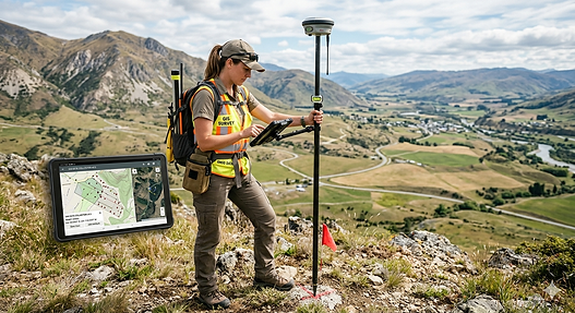
LiDAR Surveying and Geographic Information Systems (GIS) have transformed the way spatial data is collected, analyzed, and utilized across numerous industries. LiDAR, which stands for Light Detection and Ranging, uses laser pulses to measure distances between a sensor and objects on the Earth's surface, creating highly accurate three-dimensional representations of terrain, structures, and vegetation. GIS complements this technology by providing a platform to store, manage, analyze, and visualize geographic information. Together, they enable professionals to generate detailed maps, elevation models, and spatial databases for informed decision-making. Governments, engineering firms, environmental agencies, and urban planners rely on LiDAR and GIS to improve project accuracy, reduce survey time, and enhance resource management. The combination of precise data acquisition and advanced spatial analysis makes these technologies essential tools for modern geospatial applications and infrastructure development projects worldwide.
One of the primary advantages of LiDAR surveying is its ability to capture large amounts of topographic information with exceptional accuracy and speed. Airborne LiDAR systems mounted on aircraft or drones can survey extensive areas within a short period, generating millions of data points known as point clouds. These datasets are processed to create Digital Elevation Models (DEM), Digital Terrain Models (DTM), contour maps, and 3D surface representations. When integrated into a GIS environment, this information becomes even more valuable because users can perform spatial analysis, overlay multiple datasets, and identify patterns that may not be visible through traditional surveying methods. Engineers use these outputs for road and railway design, while environmental scientists apply them to watershed analysis and habitat mapping. The efficiency and precision of LiDAR significantly reduce fieldwork requirements and improve project outcomes across diverse sectors.
GIS serves as the analytical backbone that transforms raw LiDAR data into meaningful information for planning and decision-making. After LiDAR data is collected and processed, GIS software enables users to organize, classify, and interpret spatial features according to specific project objectives. Advanced GIS tools support functions such as terrain analysis, buffer creation, route optimization, network analysis, and land-use assessment. For example, urban planners can evaluate the suitability of land for new developments, while utility companies can monitor infrastructure corridors and identify potential risks. GIS also facilitates the integration of LiDAR data with satellite imagery, drone surveys, GPS observations, and demographic information to create comprehensive geospatial solutions. By combining multiple layers of geographic data, GIS provides valuable insights that help organizations make data-driven decisions while improving operational efficiency and resource allocation.
Top Rated LiDAR Surveying & GIS in Hyderabad, TS | RAYNAS GEOMATICS
Top Rated LiDAR Surveying & GIS in Hyderabad, TS.Generate accurate topographic maps LiDAR Surveying,Terrestrial LiDAR,GIS Mapping Services,Topographic Survey,Survey Mapping Services
Top Rated LiDAR Surveying & GIS in Hyderabad, TS.|Mobile LiDAR Surveying,Data Collection
The integration of LiDAR Surveying and GIS has become increasingly important in environmental monitoring and natural resource management. LiDAR technology can accurately measure forest canopy height, vegetation density, river channels, and coastal landscapes, providing critical information for conservation efforts and ecological studies. GIS systems then analyze this data to identify environmental changes, assess flood risks, monitor erosion, and support disaster management planning. During natural disasters such as floods, landslides, or wildfires, LiDAR-generated terrain models help authorities understand vulnerable areas and develop effective mitigation strategies. In agriculture, the combination of LiDAR and GIS supports precision farming by mapping field conditions and optimizing resource usage. These technologies provide a deeper understanding of environmental processes, enabling governments and organizations to make sustainable decisions that balance economic development with ecological preservation and long-term resilience.